👋 你好,欢迎来到我的技术博客!
我是一个热爱技术的开发者,在这里分享我的技术学习、项目经验与思考感悟。
关注 计算机视觉、三维重建、LiDAR 点云、SLAM 与工程实现 等方向。
🚀 最新文章
这里是我最近发布的一些技术文章:
- 3Geometry-Grounded Gaussian Splatting - 2026/2/5
- ALIKED:通过可变形变换实现更轻量的关键点和描述符提取网络 文章翻译 - 2025/12/28
- ALIKE: 准确且轻量的关键点检测与描述符提取 文章翻译 - 2025/12/28
🧩 开源项目
我积极参与开源社区,主要项目包括:
- BVH tree - 个高性能的Bounding Volume Hierarchy (BVH) 树库
- Ply IO library - 一个ply格式点云读写库
🌍 关于我 / About Me
你好,我是 胡洋(Hu Yang),目前任职于 贝壳 · 如视(realsee.com),
负责 三维重建方向 的算法研发与团队建设。
我长期专注于 计算机视觉与三维重建领域,具备丰富的算法研发与工程化落地经验,
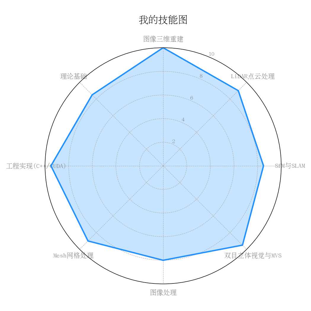
涵盖从 图像三维重建、激光 LiDAR 点云处理、标定与 SLAM、SfM、MVS、双目立体视觉、Mesh 重建 等全链条技术。
🎓 教育背景
- 🎓 本科:2003–2007 · 东北石油大学 · 资源环境与城乡规划管理专业
- 🎓 硕士:2008–2010 · 武汉大学 · 地图学与地理信息系统专业
💼 工作经历
-
2010–2011|黑龙江省测绘与地理信息局 · 基础地理信息中心
从事 WebGIS 平台开发。 -
2011–2014|中煤航测遥感局 · 技术发展研究院
机载激光 LiDAR 点云处理、摄影测量与三维重建。 -
2014–2017|景致三维股份有限公司
倾斜摄影 SfM 重建,深入研究多视几何与三维建模。 -
2017–2019|飞马机器人
负责 MVS(多视立体匹配)方向算法研发。 -
2019–至今|贝壳 / 如视(Realsee)
主导室内三维重建算法体系建设,带领团队搭建高精度三维重建基础能力,
推动 VR 看房、实景建模等技术的迭代与落地。
⚙️ 技术专长
- 🧠 计算机视觉 / 三维重建:SfM, MVS, SLAM, LiDAR 点云, 双目视觉
- 💻 图形与并行计算:C++ / OpenGL / CUDA
- 🧩 Mesh 与几何重建:点云滤波、去噪、法向估计、配准、Mesh 重建、简化、纹理映射、LOD 生成
- 🚀 算法工程化:系统架构设计、性能优化、团队培养
💡 技术理念
“三维世界的真实重建,不只是算法的堆砌,更是几何与光影的理解。”
我热衷于将复杂的视觉问题变得可工程化实现, 也喜欢探索几何与 AI 的结合边界。
📬 联系我
如果你有任何问题或想交流技术,欢迎通过以下方式联系我:
- 📧 邮箱:huyang0909@gmail.com
- 🐙 GitHub:huluoboge
🧭 不断探索真实空间的数字化表达,用算法复现世界的几何之美。
